Infographic Recommended: ChatGPT
Infographic: Trek Elevation Profile
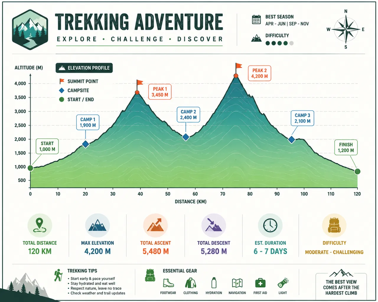
A hiking elevation profile: fluctuating mountain curves, camp markers, and kilometer scale — the visualization of high-altitude challenges.
Full prompt (English)
Outdoor trekking infographic showing an elevation profile, a flowing area curve rising and falling like mountain silhouettes in layered green-to-teal gradient, diamond campsite markers and small flag icons on the peaks, axis ticks for distance and altitude along the framed border, thin contour shading beneath the curve, abstract placeholder labels to avoid garbled text, clean modern dashboard style with compass and terrain icons, alpine energizing color palette, high resolution, 4k
Recreate this:
Copy the prompt above → open ChatGPT → paste and send (you can switch the image model) → wait for the result.
Open ChatGPT ↗
For step-by-step details, see the
tutorial.
FAQ
How do I recreate this image?▾
Copy the English prompt above, open ChatGPT, switch to an image model, paste the prompt and send — the model will generate the same look.
Which AI tool should I use?▾
Recommended target: ChatGPT. Any conversational image tool that supports long English prompts can reproduce an approximate result.
Can I customize this prompt?▾
Yes — swap the subject, style, colors or composition words with your own. The description often points out typical swap points (e.g. “swap X for Y”).
Can I use the sample image freely?▾
The sample image was generated by us with this prompt for display only; the prompt itself is free to copy and use. For commercial use, follow the terms of your chosen AI tool.